Thinking about a future assignment? .........logistics strategy, supply chain analysis? ...........mapping / demographics? ............end-to-end trade off modelling? ............need some industry research? ..............................Do get in touch: 01295 758875
 While most of our projects are measured in weeks, Aricia has completed effective projects in just a few days
Mapping & GIS
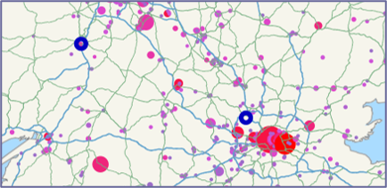
We use mapping tools for analysis and visualisation, and for preparing geographic data for modelling within consultancy assignments - they enable various logistics network design and location analysis such as:
- Facility relocation and weighted "centres of gravity"
- Visualise size of flows
- Allocate customers between fulfilment centres or depots
Read our talk through of a typical logistics mapping project.
For £27 you can buy our ebook on UK Logistics Location Strategy - fill in our contact form and someone will be back to you very shortly.
We have also helped clients in sales and marketing:
- Identifying customer hot spots
- Prioritising sales leads
- Competitor adjacency analysis
And in areas such as managing territories for field engineers.

What is Maptitude and what else can it do?
Maptitude Geographic Information System (GIS) software is cost-effective comprehensive desktop mapping software from Caliper. With Maptitude you can:
- Know exactly where your customers are and what sites are best for your business
- Identify hot-spots, geographic patterns and trends that cannot be seen in database tables and spreadsheets
- Use demographic data to model what additional business is likely to look like for your company
- Ask questions of your data based on its location, specific attributes and/or what else is in the vicinity
- Enhance your reports and presentations with maps and charts
You can see some of the other imaginative analysis and presentation options in Maptitude here on Caliper's website.
Maptitude Training
Maptitude includes extensive geographic data so you can get started as soon as you install the software. You can learn how to use Maptitude yourself - there is built-in help, which is comprehensive including many tutorials, and then there are plenty of helpful videos on Maptitude's site and on YouTube. However many people find that a more time-effective method is to undertake training.
Aricia provides UK-based
aimed at getting you started with Maptitude and more tailored training for specific needs. Aricia's training is suitable for business users who need to create maps and analyse data in a geographic way, but who are not GIS experts (and don't particularly want / need to be!). The training is a mixture of some subjects that are covered in depth and awareness of other features so that the user can return to them as required.
Or, if you need assistance with something specific, we can help you with on-the-project coaching, so you come away with useful results immediately.
Maptitude Tips
We usually change one of the tips every week or so:
Tip A: Interested in logistics network development? This case study will tell you all about how we use the relocation and other tools in cost-effective Maptitude to carry out this task.
Tip B: Legend in the wrong place? Over a key bit of your map? You can use the arrow in the drawing toolbar to grab and move the legend around. And you can also use the drawing toolbar to add a North arrow if it’s not obvious.
Tip C: The Display Manager allows you to control the style, visibility and label settings for the layers in a map ...and also the order of layers on the map – what ends up on top of what else.
Useful information provided at a good pace. Trainer very approachable
Gwennan Higham, Welsh for Adults